Folks, we here at the Scene Weather Action Center have to formally apologize here to you, the readers who trust us for accurate forecasting.
Two weeks ago we opened the weather app on the old iPhone and saw a stretch of beautiful perfection stretching into the future, temps in the 50s and high 60s, sun and good vibes all around. That led to the publication of a piece entitled, "AWWWW HELL YEAH SPRING LET'S GOOOOOOOOOOOO," a piece that it's now clear jumped the gun.
Because this weekend, in the last week of March, snowfall will return to Cleveland with the east side once again facing the brunt of the accumulation (what up, Chardon) and the temps dipping from a high of 39 (!) on Saturday to a high of 29 (!!) on Monday, before it appears Cleveland will engage in that slow climb to springtime temps.
Again, apologies for the premature spring prognosis.
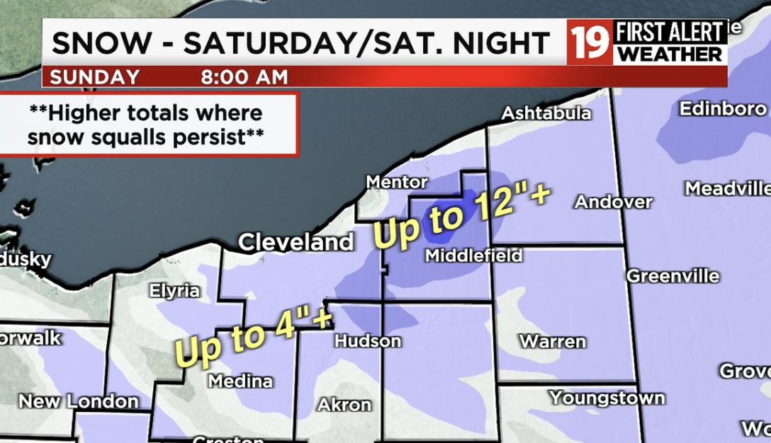
NEW DATA: Snow tracker tomorrow and Saturday night. The bullseye around Chardon. Locally a foot of lake effect snow. It all depends on where the persistent squalls set up. https://t.co/ESQdTDSzb5 pic.twitter.com/bfH09h5R8M
— Jeff Tanchak (@JeffTanchak19) March 25, 2022