
Metroparks Study a Small Step in Long, Unlikely Journey to Move I-90, Reunite Gordon Park
The layout of the freeway and parks near the recently torn down FirstEnergy power plant has long puzzled city planners, east side Cleveland residents, and even the semi-aware itinerant motorist.
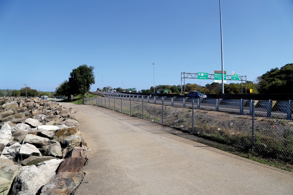
This curvy part of Interstate 90 goes close enough to the lake that waves and fish sometimes hit cars when the waters get churning. The airborne fishies Lake Erie spillage might seem minor, but the water does cause damage to the road, which is expensive to maintain.
The bigger problem, at least to some folks, is that I-90 splits Gordon Park and other spaces that should provide access to the lakefront into unusable pieces.
There has been some discussion about perhaps moving the freeway about 500 yards south of the lake with the power plant now gone. As laid out in our feature on the highway and park two years ago, Cleveland's use of the lakefront has long been about industry instead of people.
The conclusions: 1) It is a great idea to move the freeway away from the lake and allow the parks to connect, and 2) It will not likely happen because there are too many players in the mix needed to buy in. That hasn’t changed much since we did the story in 2017.
But there is news recently, however, that some of the major players are at least putting their toes in the water a bit on this.
A $125,000 grant was awarded earlier this year to the Cleveland Metroparks by the National Fish and Wildlife Foundation to look at the I-90 section near Gordon Park and “examine the potential for the beneficial re-use of local dredge materials to create natural habitats such as emergent wetlands, shrub habitat, and coastal mud flats along the shoreline to create additional habitat for bird, fish, and other species.”
The study area runs from the Cleveland Lakefront Nature Preserve (Dike-14) to Dead Man’s Curve (where I-90 and I-71 meet), and then to just south of St. Clair Ave. The Cleveland Metroparks, Ohio Department of Transportation (ODOT), Cleveland-Cuyahoga County Port Authority, Ohio Department of Natural Resources (ODNR) Office of Coastal Management, and City of Cleveland have each pitched in to cover the $251,000 cost of the study, which has been christened the “Cleveland Harbor Eastern Embayment Resilience Study,” or CHEERS.
The primary purpose is to “identify solutions that deliver multiple benefits: accommodate dredge disposal, create additional aquatic and terrestrial habitat, protect existing highway infrastructure, and enhance the lakeshore as a dynamic community asset.”
What does this all mean? Right now, very little. That's because transportation projects can get real complicated, and this one is no different.
The Northeast Ohio Areawide Coordinating Agency (NOACA) handles transportation projects for the five-county metro area, and has about $3.5 billion worth of projects they want to do right now. In order to get on that list, one has to get approval from the NOACA board reps from Lorain to Medina to Chardon to Mentor to buy in.
NOACA has long looked at this 2.5 mile stretch of I-90 as unsafe because its curves too much on the eastern part of this section near Bratenahl, and then moves on to the longtime unsafe curve on the other end. NOACA has wanted to rectify those transportation problems, and has looked at moving the freeway at the Gordon Park area as key. Those we’ve spoken with think that getting an environmental focus might free up some money and move this along faster.
That’s why the study right now is focused on the “shrub habitat” as its calling card. In order to get funding for the freeway shift, the federal, state and county funding must be acquired. Not easy to do right now, because there isn’t much left.
But there are so many problems even if everyone is on board. FirstEnergy (now called Energy Harbor) still owns the most important 54-acre property needed for this freeway move, and it will be a complicated transfer of the land given the environmental cleanup needed. Plus, they have kept their transmission substation there and have not made public any intention that they might move it.
A move of the freeway would also disrupt the area around East 55th, which means existing property owners might need to be bought out and moved.
The best way to do this would be to move the entire freeway by the inland railroad tracks for the entire length between Bratenhal and Deadman’s Curve. But that drives up costs (higher nine-figure territory) and that also would mean doing something with Cleveland Public Power’s old and abandoned building on one side of the freeway and its transmission substation on the other.
We won’t even mention how Burke Lakefront Airport might come into play.
The City of Cleveland has already done a vague study of what can be done with the old power plants site. One of the only options laid out to get the public more access closer to Lake Erie was to move the walkway 10-20 yards inland and the freeway that much to accommodate.
The likelihood of any big changes – a better freeway, a 200-acre park that could become Edgewater East, and more lakefront access for a city that needs it – being close to happening on this historic part of Cleveland? Not great right now.
But is this at least a tiny step? Yes.
Anytime a federal interstate highway change is being considered, “hurry up and wait” is the time table. Because federal transportation projects take lots of time and money and multiple agency approvals, and what you wanted in the first place is rarely what you get.
But again, baby steps.
© 2024 Cleveland Scene
